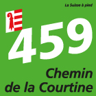
Chemin de la Courtine
Overview
Intro
This hike begins with the ascent through the Combe Tabeillon, a wild gorge you leave halfway to get to the Franches-Montagnes plateau. Past hamlets, villages, ponds and wooded pastures, the route reaches Bellelay.
Description
Starting from Glovelier railway station, the route leads through the village to the Combe Tabeillon nature reserve. The hike continues into the deep, wooded gorge, where you can see the famous little red train of the Jura railways in some places.
You then leave the gorge towards Saulcy, where magnificent views of the surroundings beckon. The route continues on the Franches-Montagnes plateau, passing the idyllic Etang des Beusses before arriving in Lajoux. In this village, the Girolle was invented as a device to scrape Tête de Moine into rosettes.
After passing through the charming village, the hike continues through forests and pastures before reaching Bellelay. Bellelay is the birthplace of Tête de Moine cheese and home to the Maison de la Tête de Moine, which includes a museum and a shop selling local products. Culture enthusiasts may also want to visit the old abbey church with its impressive organs and Baroque architecture.
An enjoyable tour includes the careful planning of the same. Please inform yourself in advance at the local information center about the route and weather conditions. Depending on the season and weather conditions, this route may be blocked or interrupted
| Start location |
Glovelier
|
|---|---|
| Destination |
Bellelay
|
| Ascent |
660 m
|
| Descent |
240 m
|
| Distance |
14 km
|
| Duration |
4 h 10 min
|
| Duration back |
3 h 40 min
|
| Technical requirements |
Easy
|
| Physical requirements |
Medium
|
| Signalization |
Signalisation in both directions
|
Jura Tourisme
Place du 23-Juin 6
2350
Saignelégier
Quick Facts
Route number


