
Gantrisch-Panoramaweg
Overview
-
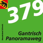
-
Distance 21 km
-
Duration 7 h
-
Ascent 1300 km
Intro
The Gantrisch Panoraweg Path offers a scenic pre-Alps hike with many spectacular viewpoints. The tour takes place on a well structured and signposted hiking path – and is a tour suitable for undertaking in stages.
Description
The Gantrisch-Panoramaweg leads over the outskirts of the towns Berne, Fribourg and Thun – and is one of the most beautiful panorama paths in this pre-Alps region. To the south the Gantrisch chain with Nüneneflue, Gantrisch, Bürgle and Ochse seems close enough to touch – and more distant the snow-capped peaks of the Alps are seen. North, views extend over the Schwarzenburgerland and Berne midlands as far as Lake Biel and Jura – and on cloudless days, as far as Feldberg in the Black Forest and the Titlis and Pilatus summits.
From the starting point in Zollhaus/FR by Plaffeien the path leads over Hällstett and the Horbüel-pass to Pfyffe, and further over the Gäggersteg (wooden-stair-climb) to Süftene (hiker’s bus stop). The hiking path then continues over Schüpfeflue to the Selibuel viewpoint. After the Gurnigel Berghaus destination, the path descends northbound to the endpoint Gurnigelbad. A pleasurable hike with numerous lookouts, seating banks and picnic and rest places along the way!

An enjoyable tour includes the careful planning of the same. Please inform yourself in advance at the local information center about the route and weather conditions. Depending on the season and weather conditions, this route may be blocked or interrupted
| Start location |
Plaffeien (Zollhaus)
|
|---|---|
| Destination |
Gurnigelbad
|
| Direction |
One way
|
| Ascent |
1300 km
|
| Descent |
1000 km
|
| Distance in km |
21 km
|
| Duration |
7 h
|
| Duration back |
6 h 40 min
|
| Technical requirements |
Easy
|
| Physical requirements |
Difficult
|
| Theme |
With panoramic view, Through a nature conservation area
|
| Shape |
Signalisation in both directions
|
| Więcej informacji | https://schweizmobil.ch/en/hiking-in-switzerland/r... |
Quick Facts
Route number


